
The indicative plan for the eastern bypass is presented on a design map showing four route options. They differ in the point where the road connects to the existing route of voivodeship road no. 297 near Łąka and in the location and angle at which it crosses railway line no. 282. All the options shown end at the existing roundabout along national road no. 94 in Kruszyn.
At present, the designers’ task is to analyse possible options for comprehensive solutions aimed at improving the safety, capacity and functionality of the eastern bypass. The solutions most advantageous in financial, logistical and social terms.
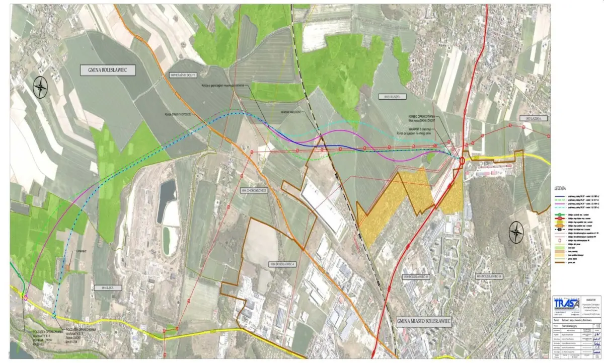
It is worth recalling that in January this year, the Lower Silesian Roads and Railways Service in Wrocław signed an agreement for the design of the construction of the second stage of the Bolesławiec bypass. The investment is intended to continue the construction of a new connection enabling travel from the A4 motorway junction to towns south and east of Bolesławiec without having to drive through the town.
The planned section will connect voivodeship road no. 297 with national road no. 94 towards the Krzywa junction and, via the existing south-eastern section of the Bolesławiec bypass, with voivodeship road no. 363 towards Złotoryja. The design documentation is being prepared by Biuro Projektów TRASA Sp. z o.o. of Poznań.